Remote Sensing Satellite Market Size & Growth Forecast 2027–2036, By Segments (Satellite Mass, Orbit, End-use, Application), Regional Demand Trends (North America, Asia Pacific, Europe), Key Country Insights (U.S., Japan, South Korea, Germany, France, Italy), and Competitive Landscape
Market Size and Growth Outlook
Remote Sensing Satellite Market size was over USD 51.37 Billion in 2026 and is likely to grow at 13.94% CAGR between 2027 and 2036, crossing USD 189.44 Billion by 2036. The industry revenue for 2027 is estimated at USD 57.57 Billion.
Get more details on this report
Request Free Sample ReportRemote Sensing Satellite Market Intelligence Snapshot
Regional Market Dynamics
- North America held 45.05% in 2026, driven by advanced space infrastructure, established satellite capabilities, and broad adoption across defense, agriculture, infrastructure, and environmental applications.
- Asia Pacific is the fastest-growing region, supported by urbanization, infrastructure expansion, disaster preparedness, expanding space programs, and greater commercial satellite participation.
Segment Momentum
- Satellites above 1000 kg held a 72% market share in 2026 due to their ability to carry advanced sensing instruments, high-performance payloads, and sophisticated data-processing capabilities for complex observation missions.
- Commercial applications are growing the fastest as industries increasingly use satellite data for operational planning, asset monitoring, resource assessment, and data-driven decision-making across multiple sectors.
Market Expansion Drivers
- Expanding earth observation demand accelerating high-resolution satellite data commercialization
- AI and machine learning integration improving satellite analytics and geospatial insights
- Government space programs and defense modernization accelerating satellite constellation deployment
Leading Market Participants
- Key players in the remote sensing satellite market include Airbus SE (France), Maxar Technologies Inc. (United States), Lockheed Martin Corporation (United States), Northrop Grumman Corporation (United States), Thales Alenia Space (France), Boeing Company (United States), BAE Systems plc (United Kingdom), SpaceX (United States), OHB SE (Germany), Indian Space Research Organisation (India)
Global Market Forecast Snapshot
Market Outlook
- 2026 Market Size: USD 51.37 Billion
- 2027 Estimated Market Size: USD 57.57 Billion
- Projected Market Size: USD 189.44 Billion by 2036
- Growth Forecast: 13.94% CAGR (2027-2036)
Regional and Segment Outlook
- Leading Regional Market: North America
- High-Growth Regional Hub: Asia Pacific
- Core Revenue Segment: Above 1000 Kg (Satellite Mass) | Low Earth Orbit (LEO) (Orbit) | Government (End-use) | Weather Forecasting (Application)
- Emerging Opportunity Segment: Above 1000 Kg (Satellite Mass) | Low Earth Orbit (LEO) (Orbit) | Commercial (End-use) | Agriculture and Forestry Farming (Application)
Market Growth Drivers and Industry Trends
Expanding earth observation demand accelerating high-resolution satellite data commercialization
The growing need for accurate and timely geospatial information across commercial, environmental, and public sector applications is increasing the value of satellite-based earth observation services. The remote sensing satellite market growth is driven by rising demand for high-resolution imagery used in agriculture, urban planning, natural resource management, disaster response, and environmental monitoring. Organizations are increasingly relying on commercial satellite data to support informed decision-making through frequent and detailed observations of changing ground conditions. The expanding use of value-added geospatial services is also encouraging satellite operators to enhance imaging capabilities and broaden access to commercial data products.
AI and machine learning integration improving satellite analytics and geospatial insights
Artificial intelligence and machine learning are transforming the way satellite imagery is processed by enabling faster extraction of meaningful information from large geospatial datasets. This technological advancement will drive the remote sensing satellite market growth through automated image classification, object detection, predictive modeling, and real-time change analysis that reduce manual interpretation efforts. Advanced analytics improve the ability of users to identify patterns, monitor infrastructure, track environmental changes, and respond quickly to emerging events. These capabilities are expanding the practical applications of satellite data across industries that require timely and accurate geospatial intelligence for operational planning.
Government space programs and defense modernization accelerating satellite constellation deployment
National investments in space capabilities and defense infrastructure are increasing the deployment of satellite constellations designed to strengthen surveillance, security, and strategic intelligence. In the remote sensing satellite market, government agencies are supporting the development of advanced observation satellites that provide continuous coverage, improved revisit frequency, and enhanced imaging performance for civilian and military applications. Defense modernization initiatives are also driving demand for resilient space-based assets capable of supporting border monitoring, maritime surveillance, disaster management, and national security operations. These programs encourage sustained investment in satellite manufacturing, launch activities, and supporting ground infrastructure.
| Growth Driver | Impact on CAGR | Regulatory Influence | Geographic Relevance | Adoption Rate | Impact Timeline |
|---|---|---|---|---|---|
| Expanding earth observation demand accelerating high-resolution satellite data commercialization | 2% | High | North America, Europe | High | Near Term |
| AI and machine learning integration improving satellite analytics and geospatial insights | 1.8% | High | North America, Asia Pacific | High | Near Term |
| Government space programs and defense modernization accelerating satellite constellation deployment | 1.6% | High | Europe, Asia Pacific | High | Mid Term |
Unlock insights tailored to your business with our bespoke market research solutions.
Click to get your customized report now.
Regional Demand Dynamics
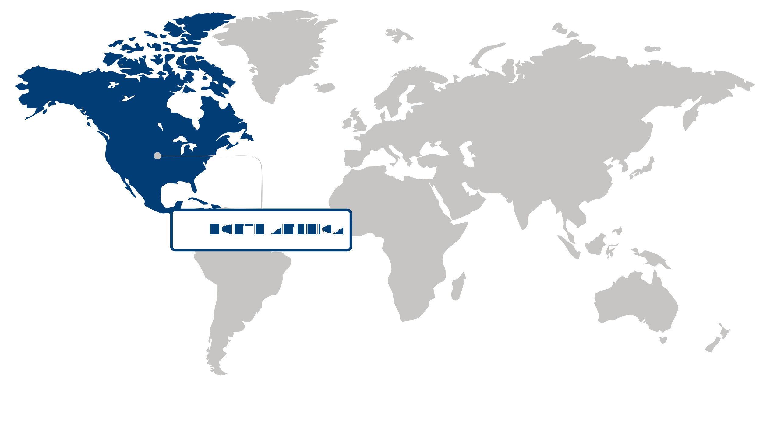
North America (Largest Region)
Holding a 45.05% share of the remote sensing satellite market in 2026, North America maintained its leading position due to strong demand for satellite-derived information across defense, environmental monitoring, agriculture, disaster management, infrastructure planning, and resource management. The region benefits from advanced space infrastructure, established satellite development capabilities, and broad adoption of geospatial intelligence across public and commercial applications. Increasing reliance on high-resolution imagery and timely earth observation data is supporting the integration of remote sensing into decision-making processes. Continued investment in satellite technologies, data processing capabilities, and applications that combine imagery with advanced analytics is further strengthening the regional market.
Asia Pacific (Fastest-Growing Region)
Asia Pacific is projected to be the fastest-growing region as governments and commercial organizations increasingly use satellite-based observation for urban planning, agriculture, environmental monitoring, maritime activities, and disaster preparedness. Rapid urbanization and infrastructure expansion are generating greater demand for detailed geospatial information, while the region's exposure to natural hazards is encouraging investment in monitoring and early-warning capabilities. Expanding space programs and growing participation from commercial satellite operators are also improving regional access to remote sensing technologies. The increasing use of satellite imagery with digital mapping, analytics, and other data-driven applications is expected to accelerate adoption across a broad range of industries.
| Parameter | North America | Asia Pacific | Europe | Latin America | MEA |
|---|---|---|---|---|---|
| Innovation Hub i Scale Nascent Developing Advanced | |||||
| Cost-Sensitive Region i Scale Low Medium High | |||||
| Regulatory Environment i Scale Restrictive Neutral Supportive | |||||
| Demand Drivers i Scale Weak Moderate Strong | |||||
| Development Stage i Scale Emerging Developing Developed | |||||
| Adoption Rate i Scale Low Medium High | |||||
| New Entrants / Startups i Scale Sparse Moderate Dense | |||||
| Macro Indicators i Scale Weak Stable Strong |
Key Country Insights
United States 🇺🇸
Earth Observation ExpansionThe U.S. advances remote sensing satellite capabilities for environmental monitoring, defense intelligence, agriculture, and commercial analytics. Investment continues to strengthen high-resolution imaging, data processing, and constellation-based observation services.
Germany 🇩🇪
Industrial Imaging CapabilityGermany supports remote sensing satellite development through strong aerospace engineering and advanced optical technologies. National priorities emphasize precise Earth observation, climate monitoring, and integration of satellite data into industrial applications.
Japan 🇯🇵
Disaster Monitoring SystemsJapan prioritizes remote sensing satellites that strengthen disaster response, environmental surveillance, and infrastructure assessment. Continuous investment in sensor innovation improves data quality and supports rapid decision-making across public and commercial sectors.
South Korea 🇰🇷
Domestic Space DevelopmentSouth Korea is expanding remote sensing satellite programs to enhance national space capabilities and geospatial services. Local organizations emphasize advanced imaging payloads and greater independence in Earth observation missions.
France 🇫🇷
Civil Space ApplicationsFrance leverages its established space industry to develop remote sensing satellites for environmental, security, and scientific applications. Development priorities include advanced payload technologies and collaborative Earth observation initiatives across multiple sectors.
Italy 🇮🇹
Geospatial Data ServicesItaly applies remote sensing satellite technologies to environmental monitoring, agriculture, infrastructure management, and disaster assessment. Organizations increasingly focus on converting satellite imagery into value-added geospatial services for commercial and institutional users.
Segment Leadership and Growth Trends
Remote Sensing Satellite Market Share (%), by Satellite Mass, 2026
Go beyond the chart, access full insights & data tables
Request Free Sample ReportSatellite Mass Segment Analysis: Above 1000 Kg (Largest & Fastest-Growing Segment)
The above 1000 kg satellite segment dominated the remote sensing satellite market, accounting for a 72% share in 2026, while also representing the fastest-growing segment. Its leading position is supported by the ability of larger satellites to accommodate sophisticated sensing instruments, high-performance payloads, and advanced communication and data-processing capabilities. These systems are well suited to applications requiring broad-area observation, high-quality imaging, and continuous collection of detailed earth data. Growing demand for reliable information related to environmental monitoring, climate assessment, natural resource management, and national security is further strengthening the role of high-mass satellite platforms. Continued investment in advanced remote sensing capabilities and increasingly complex mission requirements is expected to sustain strong demand for these systems.
Orbit Segment Analysis: Low Earth Orbit (LEO) (Largest & Fastest-Growing Segment)
Low earth orbit (LEO) held the largest share of the remote sensing satellite market in 2026 and remained the fastest-growing orbit segment, supported by its suitability for high-resolution earth observation and frequent data collection. Satellites operating in LEO can provide detailed imagery and sensing capabilities that are valuable for applications such as environmental surveillance, agriculture, disaster management, urban planning, and defense monitoring. The relatively close proximity to earth also supports effective observation of surface features and enables the use of advanced imaging technologies. Rising demand for timely geospatial intelligence, improved monitoring of changing environmental conditions, and increasingly data-driven decision-making is encouraging broader adoption of LEO-based remote sensing systems.
End-use Segment Analysis: Government (Largest Segment) vs Commercial (Fastest-Growing Segment)
Government applications represented the largest end-use segment of the remote sensing satellite market in 2026, reflecting the strategic importance of satellite-derived information for defense, national security, environmental monitoring, disaster response, and public resource management. Government agencies rely on remote sensing capabilities to observe large geographic areas, assess changing conditions, support emergency planning, and strengthen decision-making through reliable geospatial data. The growing need for situational awareness and independent access to earth observation information continues to support public-sector investment in remote sensing infrastructure and satellite-based intelligence.
Commercial applications are expected to experience the fastest growth as businesses increasingly use satellite-derived data to improve operational planning, monitor assets, and support data-driven services. Industries such as agriculture, energy, infrastructure, logistics, and environmental management can benefit from timely earth observation information for resource assessment and risk evaluation. Advances in satellite imaging, data analytics, and the broader availability of remotely sensed information are also lowering barriers to commercial adoption. As private-sector users increasingly recognize the value of satellite intelligence for improving efficiency and managing operational risks, commercial demand is gaining momentum across a wider range of industries.
| Segment | Sub-Segment | Largest Segment | Fastest Growing |
|---|---|---|---|
| Satellite Mass | Less Than 100 Kg, 100 -500 KG, 500 -1000 Kg, Above 1000 Kg | Above 1000 Kg | Above 1000 Kg |
| Orbit | Low Earth Orbit (LEO), Medium Earth Orbit (MEO), Geostationary Earth Orbit (GEO) | Low Earth Orbit (LEO) | Low Earth Orbit (LEO) |
| End-use | Government, Commercial | Government | Commercial |
| Application | Weather Forecasting, Agriculture and Forestry Farming, Infrastructure and Urban Planning, Others | Weather Forecasting | Agriculture and Forestry Farming |
Competitive Landscape and Market Positioning
Prominent players in the remote sensing satellite market:
- Airbus SE (France)
- Maxar Technologies, Inc. (United States)
- Lockheed Martin Corporation (United States)
- Northrop Grumman Corporation (United States)
- Thales Alenia Space (France)
- Boeing Company (United States)
- BAE Systems plc (United Kingdom)
- SpaceX (United States)
- OHB SE (Germany)
- Indian Space Research Organisation (India)
Strategic rivalry within the remote sensing satellite market is being reshaped by the growing importance of high-quality data services rather than satellite manufacturing alone. Market participants are expanding their capabilities across the value chain by combining advanced sensing technologies with sophisticated data processing and analytical platforms that deliver more actionable information for commercial and public-sector users. The ability to provide frequent, reliable, and application-specific imagery is emerging as a stronger differentiator than hardware specifications in isolation, encouraging greater investment in software, automation, and data interpretation capabilities. At the same time, customers increasingly favor providers that can deliver integrated solutions tailored to industry-specific decision-making rather than standalone imaging assets.
| Company | Market Share | Company Revenue | Revenue CAGR (%) | Product Portfolio | Geographic Presence | Innovation / R&D Focus | Strategic Developments |
|---|---|---|---|---|---|---|---|
| Airbus SE (France) | |||||||
| Maxar Technologies Inc. (United States) | |||||||
| Lockheed Martin Corporation (United States) | |||||||
| Northrop Grumman Corporation (United States) | |||||||
| Thales Alenia Space (France) | |||||||
| Boeing Company (United States) | |||||||
| BAE Systems plc (United Kingdom) | |||||||
| SpaceX (United States) | |||||||
| OHB SE (Germany) | |||||||
| Indian Space Research Organisation (India) |
Industry Development/News
| Company Name | Date | Key Development |
|---|---|---|
| GalaxEye | May-26 | GalaxEye successfully deployed its Drishti satellite, the world’s first OptoSAR satellite, via a SpaceX Falcon-9 mission. This launch significantly enhances commercial remote sensing capabilities by integrating optical and synthetic aperture radar technologies into a single platform, providing advanced observation capabilities for various Earth monitoring applications. |
| Galactic Energy | May-24 | Galactic Energy achieved a record-setting performance for a private Chinese launch provider by executing two commercial rocket launches within a three-day window. This rapid turnaround capacity provides a strategic advantage in the commercial remote sensing market, significantly lowering barriers to orbit and facilitating more frequent deployment cycles for Earth observation satellite constellations. |
| Taiwan Space Agency | May-24 | The Taiwan Space Agency accelerated development of its FORMOSAT-8 satellite program, featuring upgraded optical instrumentation designed to enhance real-time high-resolution imaging. This initiative reflects a strategic focus on expanding indigenous Earth observation infrastructure to support critical applications in disaster management and land-use monitoring across the region. |
| Azista BST Aerospace | Jun-23 | Azista BST Aerospace Pvt. Ltd. (ABA) achieved a significant milestone with the launch of its ABA First Runner (AFR) satellite aboard a SpaceX Falcon 9 rocket. Built on a modular bus platform, the 80 kg satellite is equipped with a wide-swath optical payload capable of multispectral and panchromatic imaging, demonstrating the commercial scalability of compact remote sensing platforms. |
| Airbus Defence and Space | Jan-23 | Airbus Defence and Space secured a comprehensive contract to deliver a complete geospatial intelligence system to Poland. The agreement involves the manufacturing, launch, and in-orbit delivery of two advanced optical Earth observation satellites, alongside the deployment of a Direct Receiving Station and associated ground segment services, marking a major investment in sovereign remote sensing infrastructure. |
Customize Your Report
Explore examples of how this report can be tailored to different research needs, including custom segments, additional topics or chapters, and related reports. Click a section of the wheel or its numbered marker to explore the available options.
Remote Sensing Satellite Market — Custom Segments
| Segment | Sub-Segment |
|---|---|
| Sensor Technology | Optical Imaging, Synthetic Aperture Radar (SAR), Multispectral & Hyperspectral Imaging, LiDAR |
| Imaging Resolution | Very High Resolution, High Resolution, Medium Resolution, Low Resolution |
| Revisit Frequency | Sub-Daily Revisit, Daily Revisit, Weekly Revisit, Monthly or Longer Revisit |
Remote Sensing Satellite Market — Custom TOC
| Custom Chapter | Custom Details |
|---|---|
| Satellite Data Commercialization Models |
|
| Constellation Deployment Strategies |
|
| Space Sustainability & End-of-Life Strategies |
|
Need a different cut of the data?
Request Custom ResearchWhat is the market valuation of remote sensing satellite?
What are the growth projections for the remote sensing satellite industry?
How is AI integration enhancing the commercial value of remote sensing satellite data?
Why are government space programs accelerating growth in the remote sensing satellite market?
Why do satellites above 1000 kg dominate the remote sensing satellite market?
Why are commercial applications the fastest-growing end-use segment?
How has North America maintained leadership in the remote sensing satellite market?
What is driving remote sensing satellite market growth in Asia Pacific?
Which companies dominate the remote sensing satellite landscape?
Our Clients
"The reports offered a comprehensive view of the Food and Beverage landscape, covering market trends, consumer behavior, and competitive dynamics."
Terma A/S
"Our experience in acquiring market research reports has been outstanding — the depth of analysis and actionable insights have proven invaluable."
The Aerospace Corporation
"Fundamental Business Insights demonstrated a keen understanding of our business needs, delivering reports tailored to our specific objectives."
Kongsberg Gruppen
Our Research Team & Methodology
Every Fundamental Business Insights report is built by a dedicated vertical research team, validated through a structured primary-and-secondary methodology, and reviewed for accuracy before it reaches you.
Research Team Overview
Prepared by the Aerospace & Defence Research Team
Delivery
Published
Demand
Available
Support
Trust & Compliance
Research Domains
10 coverage areasResearch Intelligence
| Source | Reference |
|---|---|
| International Civil Aviation Organization (ICAO) | www.icao.int |
| International Air Transport Association (IATA) | www.iata.org |
| Federal Aviation Administration (FAA) | www.faa.gov |
| European Union Aviation Safety Agency (EASA) | www.easa.europa.eu |
| Aerospace Industries Association (AIA) | www.aia-aerospace.org |
| NATO | www.nato.int |
| U.S. Department of Defense (DoD) | www.defense.gov |
| Defense Advanced Research Projects Agency (DARPA) | www.darpa.mil |
| National Aeronautics and Space Administration (NASA) | www.nasa.gov |
| European Space Agency (ESA) | www.esa.int |
| SAE International | www.sae.org |
| RTCA | www.rtca.org |
| ASTM International | www.astm.org |
| International Organization for Standardization (ISO) | www.iso.org |
| National Institute of Standards and Technology (NIST) | www.nist.gov |
| International Organization for Standardization - Aerospace (IAQG standards via 9100 series) | iaqg.org |
| Airports Council International (ACI World) | aci.aero |
| Missile Defense Agency (MDA) | www.mda.mil |
| Stockholm International Peace Research Institute (SIPRI) | www.sipri.org |
| Jane's (Janes) | www.janes.com |
Research Workflow & Quality Assurance
Data Collection
Verified information gathered through primary and secondary research.
Data Triangulation
Cross-validation using multiple independent data sources.
Forecast Modelling
Market estimates developed using historical trends and analytical models.
Analyst Validation
Findings reviewed by domain experts for accuracy and consistency.
Editorial & Quality Review
Final editorial, quality, and compliance checks before publication.
Final Publication
Released after successful completion of the internal review process.
Report Coverage
📊 Market Assessment
- Market Size & Forecast
- Market Segmentation
- Regional Analysis
- Growth Drivers & Challenges
- Market Dynamics
🏢 Competitive Intelligence
- Competitive Landscape
- Company Profiles
- Competitive Benchmarking
- Mergers & Acquisitions
- Market Share Analysis or Key Company Strategies
🔍 Strategic Analysis
- Value Chain Analysis
- Porter's Five Forces
- PESTLE Analysis
- Pricing Trends
- Supply-Demand Analysis
🚀 Future Outlook
- Technology Landscape
- Regulatory Landscape
- Investment & Funding Landscape
- Emerging Opportunities
- Future Market Outlook
Have a question about this report or need a custom scope?
Request Customization