Mobile Mapping Market Size & Growth Forecast 2027–2036, By Segments (Component, Technology Type, Mounting Type, Industry Vertical, Application), Regional Demand Trends (North America, Asia Pacific, Europe), Key Country Insights (U.S., Japan, South Korea, Germany, France, Italy), and Competitive Landscape
Market Size and Growth Outlook
Mobile Mapping Market size was more than USD 47.01 Billion in 2026 and is set to grow at a 15.58% CAGR between 2027 and 2036, surpassing USD 199.99 Billion by 2036. The industry revenue for 2027 is estimated at USD 53.18 Billion.
Get more details on this report
Request Free Sample ReportMobile Mapping Market Intelligence Snapshot
Regional Market Dynamics
- North America held a 29.16% market share in 2026, supported by strong adoption across transportation, utilities, urban planning, and infrastructure monitoring requiring high-accuracy geospatial data.
- Asia Pacific is projected to grow at an 18.26% CAGR, driven by infrastructure expansion, smart city initiatives, and rising demand for efficient large-scale geospatial data collection.
Segment Momentum
- Hardware accounted for 55.65% of the market in 2026 because sensors, cameras, scanners, and positioning systems are essential for field data capture, while upgrades and replacement cycles sustain demand.
- LiDAR is the fastest-growing technology as organizations increasingly require highly detailed 3D mapping and precise spatial data for roads, infrastructure, terrain, and environmental modeling applications.
Market Expansion Drivers
- Rapid adoption of LiDAR and GNSS-enabled mapping systems enhancing real-time spatial data capture.
- Expansion of smart city and infrastructure projects driving high-precision geospatial analytics demand.
- Integration of drones and IoT sensors improving large-scale automated mapping and surveying workflows.
Leading Market Participants
- Leading companies in the mobile mapping market include Alphabet Inc. (United States), Trimble Inc. (United States), Hexagon AB (Sweden), TOPCON CORPORATION (Japan), Teledyne Technologies Incorporated (United States), RIEGL Laser Measurement Systems GmbH (Austria), GreenValley International Inc. (United States), Hi-Target Surveying Instrument Co., Ltd. (China), imajing SAS (France), FARO Technologies, Inc. (United States).
Global Market Forecast Snapshot
Market Outlook
- 2026 Market Size: USD 47.01 Billion
- 2027 Estimated Market Size: USD 53.18 Billion.
- Projected Market Size: USD 199.99 Billion by 2036
- Growth Forecast: 15.58% CAGR (2027-2036)
Regional and Segment Outlook
- Leading Regional Market: North America
- High-Growth Regional Hub: Asia Pacific
- Core Revenue Segment: Hardware (Component) | GNSS (Technology Type) | Drone-Mounted (Mounting Type) | Agriculture (Industry Vertical) | Automotive Navigation (Application)
- Emerging Opportunity Segment: Software (Component) | LiDAR (Technology Type) | Vehicle-Mounted (Mounting Type) | Government & Public Sector (Industry Vertical) | 3D Modeling (Application)
Market Growth Drivers and Industry Trends
Rapid adoption of LiDAR and GNSS-enabled mapping systems enhancing real-time spatial data capture
Growing adoption of LiDAR and GNSS technologies is improving the ability to collect detailed spatial information directly from mobile platforms. These capabilities will drive mobile mapping market growth by enabling faster and more precise capture of geographic data, while real-time positioning supports accurate mapping across varied environments. The combination of sensing and positioning technologies also strengthens the usefulness of mobile systems for professional surveying and spatial data applications.
Expansion of smart city and infrastructure projects driving high-precision geospatial analytics demand
Smart city initiatives and expanding infrastructure projects require reliable spatial information to support planning, development, and asset assessment. For the mobile mapping market, this is increasing demand for high-precision geospatial analytics that can provide detailed information about physical environments. Mobile mapping systems allow project teams to gather location-based data efficiently across infrastructure sites, urban areas, and other complex environments requiring accurate spatial analysis.
Integration of drones and IoT sensors improving large-scale automated mapping and surveying workflows
The integration of drones with IoT sensors is enabling mapping and surveying activities to cover larger areas with greater automation. Mobile mapping market growth is supported by these capabilities because connected sensing platforms can collect spatial information across extensive or difficult-to-access locations while reducing reliance on conventional field processes. Continuous sensor connectivity also improves the flow of collected information into digital mapping and surveying workflows.
| Growth Driver | Impact on CAGR | Regulatory Influence | Geographic Relevance | Adoption Rate | Impact Timeline |
|---|---|---|---|---|---|
| Rapid adoption of LiDAR and GNSS-enabled mapping systems enhancing real-time spatial data capture | 2.30% | Moderate | North America, Asia Pacific | High | Near Term |
| Expansion of smart city and infrastructure projects driving high-precision geospatial analytics demand | 2.00% | High | Asia Pacific, Europe | High | Near Term |
| Integration of drones and IoT sensors improving large-scale automated mapping and surveying workflows | 1.80% | Moderate | North America, Asia Pacific | Medium | Mid Term |
Unlock insights tailored to your business with our bespoke market research solutions.
Click to get your customized report now.
Regional Demand Dynamics
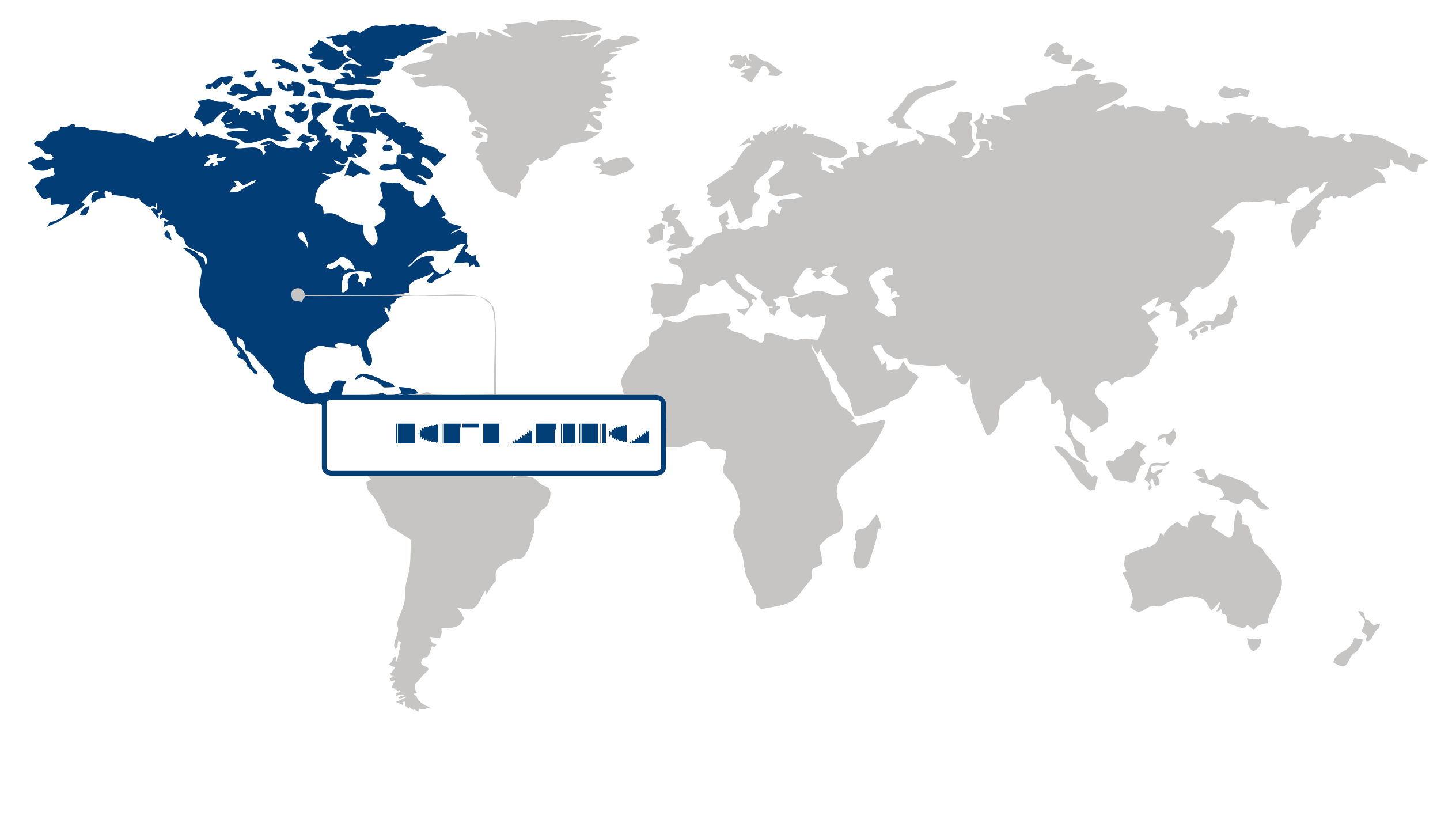
North America (Largest Region)
North America accounted for a 29.16% share of the mobile mapping market in 2026, supported by advanced geospatial infrastructure and strong adoption of location-based technologies across transportation, construction, utilities, public safety, and asset management. Organizations in the region increasingly rely on high-resolution spatial data to improve infrastructure planning, monitor assets, and streamline field operations. The integration of LiDAR, imaging systems, positioning technologies, and cloud-based data processing is enhancing the efficiency and accuracy of mobile mapping workflows. Mature digital infrastructure and continued investment in smart transportation and urban development are further strengthening demand for mobile mapping solutions across public and private-sector applications.
Asia Pacific (Fastest-Growing Region)
Asia Pacific is experiencing the fastest expansion in the mobile mapping market as rapid urbanization, infrastructure development, and digital transformation increase the need for detailed geospatial information. Large-scale transportation, construction, utility, and urban planning activities are encouraging governments and enterprises to adopt technologies capable of capturing and processing location data efficiently. Growing use of autonomous systems, smart-city platforms, and digital infrastructure management is further widening the role of mobile mapping. Improvements in surveying technologies, expanding connectivity, and greater investment in modern geospatial capabilities are enabling broader deployment across both developed and emerging economies in the region.
| Parameter | North America | Asia Pacific | Europe | Latin America | MEA |
|---|---|---|---|---|---|
| Innovation Hub i Scale Nascent Developing Advanced | |||||
| Cost-Sensitive Region i Scale Low Medium High | |||||
| Regulatory Environment i Scale Restrictive Neutral Supportive | |||||
| Demand Drivers i Scale Weak Moderate Strong | |||||
| Development Stage i Scale Emerging Developing Developed | |||||
| Adoption Rate i Scale Low Medium High | |||||
| New Entrants / Startups i Scale Sparse Moderate Dense | |||||
| Macro Indicators i Scale Weak Stable Strong |
Key Country Insights
Germany 🇩🇪
Industrial Survey PrecisionGermany prioritizes mobile mapping solutions that support transportation infrastructure, engineering, and industrial digitalization projects. Demand centers on highly accurate geospatial data collection that integrates with BIM and digital twin initiatives.
France 🇫🇷
Public Infrastructure AnalyticsFrance emphasizes mobile mapping solutions for transportation networks, municipal asset management, and environmental monitoring. Public agencies and engineering firms increasingly rely on detailed geospatial datasets to support infrastructure modernization programs.
Italy 🇮🇹
Heritage Asset DocumentationItaly utilizes mobile mapping technologies to support transportation projects alongside cultural heritage preservation and urban redevelopment. Organizations prioritize accurate digital surveying solutions that streamline infrastructure planning and long-term asset management.
Japan 🇯🇵
Urban Mapping EfficiencyJapan adopts mobile mapping technologies to improve urban planning, smart transportation, and disaster resilience initiatives. Organizations focus on compact, high-precision systems capable of efficiently capturing data across densely developed environments.
South Korea 🇰🇷
Smart Infrastructure MappingSouth Korea expands mobile mapping deployment for smart city development, connected mobility, and telecommunications infrastructure. Businesses increasingly integrate real-time geospatial data with intelligent analytics to improve infrastructure planning and maintenance.
United States 🇺🇸
Geospatial Innovation HubThe U.S. advances the mobile mapping market through autonomous mobility, infrastructure monitoring, and utility asset management applications. Organizations increasingly deploy AI-enabled mapping platforms that combine LiDAR, imaging, and cloud analytics for faster decision-making.
Segment Leadership and Growth Trends
Mobile Mapping Market Share (%), by Component, 2026
Go beyond the chart, access full insights & data tables
Request Free Sample ReportComponent Segment Analysis: Hardware (Largest Segment) vs Software (Fastest-Growing Segment)
Hardware accounted for the largest share of 55.65% in the mobile mapping market in 2026. The segment benefits from the essential role of positioning, imaging, scanning, and sensing equipment in collecting geospatial information from moving platforms. High-quality cameras, positioning systems, laser scanners, and other sensing components provide the underlying data required for mapping roads, infrastructure, urban environments, and other physical assets. Growing demand for accurate geospatial data and the expansion of mobile surveying applications are encouraging organizations to invest in sophisticated hardware capable of capturing detailed information efficiently across large and complex environments.
Software represents the fastest-growing component as mobile mapping workflows increasingly depend on advanced platforms for processing, interpreting, visualizing, and managing large volumes of spatial data. Modern software can integrate information from multiple sensors, automate data processing, generate detailed maps, and support visualization for planning and asset management activities. The increasing use of geospatial intelligence in infrastructure development, transportation, urban planning, and asset monitoring is raising the importance of software-driven analysis. Greater automation and demand for faster conversion of field-collected data into actionable information are further accelerating software adoption.
Technology Type Segment Analysis: GNSS (Largest Segment) vs LiDAR (Fastest-Growing Segment)
Holding the largest share of the mobile mapping market, GNSS accounted for 50.88% in 2026, reflecting its fundamental role in determining accurate geographic position during mobile data collection. GNSS technology provides the location reference required to associate captured imagery, measurements, and other sensor outputs with precise coordinates. Its broad applicability across surveying, transportation mapping, infrastructure assessment, and geospatial data collection supports widespread integration into mobile mapping platforms. Continued demand for reliable positioning and efficient field-based data acquisition therefore maintains GNSS as a core technology within mobile mapping systems.
LiDAR is the fastest-growing technology type, supported by increasing demand for highly detailed three-dimensional representations of physical environments. LiDAR enables mobile mapping platforms to capture dense spatial information from roads, buildings, terrain, vegetation, and infrastructure, making it particularly valuable for applications where conventional imaging may not provide sufficient depth information. Its growing integration with other positioning and imaging technologies is improving the capabilities of mobile mapping systems while expanding their use in infrastructure inspection, urban development, transportation planning, and digital asset management.
| Segment | Sub-Segment | Largest Segment | Fastest Growing |
|---|---|---|---|
| Component | Hardware, Software, Services | Hardware | Software |
| Technology Type | GNSS, RADAR, LiDAR | GNSS | LiDAR |
| Mounting Type | Vehicle-Mounted, Railway-Mounted, Drone-Mounted, Others | Drone-Mounted | Vehicle-Mounted |
| Industry Vertical | Agriculture, Oil & Gas, Government & Public Sector, Telecommunication, Energy & Utilities, Others | Agriculture | Government & Public Sector |
| Application | Asset Management, Automotive Navigation, Infrastructure Maintenance, Topographic Mapping, 3D Modeling, Road Surveys, Others | Automotive Navigation | 3D Modeling |
Competitive Landscape and Market Positioning
Major players in the mobile mapping market:
1. Alphabet Inc. (United States)
2. Trimble Inc. (United States)
3. Hexagon AB (Sweden)
4. TOPCON CORPORATION (Japan)
5. Teledyne Technologies Incorporated (United States)
6. RIEGL Laser Measurement Systems GmbH (Austria)
7. GreenValley International Inc. (United States)
8. Hi-Target Surveying Instrument Co. Ltd. (China)
9. imajing SAS (France)
10. FARO Technologies Inc. (United States)
The mobile mapping market is expanding rapidly with advanced geospatial data capture technologies. Integration of AI and real-time analytics is improving mapping accuracy and usability. Increased adoption across infrastructure and urban planning is driving innovation. The mobile mapping market is becoming essential for precision-driven spatial intelligence solutions.
| Company | Market Share | Company Revenue | Revenue CAGR (%) | Product Portfolio | Geographic Presence | Innovation / R&D Focus | Strategic Developments |
|---|---|---|---|---|---|---|---|
| Alphabet Inc. (United States) | |||||||
| Trimble Inc. (United States) | |||||||
| Hexagon AB (Sweden) | |||||||
| TOPCON CORPORATION (Japan) | |||||||
| Teledyne Technologies Incorporated (United States) | |||||||
| RIEGL Laser Measurement Systems GmbH (Austria) | |||||||
| GreenValley International Inc. (United States) | |||||||
| Hi-Target Surveying Instrument Co. Ltd. (China) | |||||||
| imajing SAS (France) | |||||||
| FARO Technologies Inc. (United States). |
Industry Development/News
| Company Name | Date | Key Development |
|---|---|---|
| Woolpert | Jul-25 | Woolpert acquired UK-based Bluesky International to expand its global geospatial services portfolio. The acquisition significantly enhances Woolpert’s aerial mapping and high-resolution data capture capabilities, strengthening its competitive position in providing integrated geospatial solutions for large-scale infrastructure, environmental monitoring, and government-sector mapping projects. |
| Leica Geosystems | Jul-25 | Leica Geosystems introduced the Pegasus TRK300 mobile mapping system, utilizing dual-head multi-beam laser scanning. The system is designed to increase field efficiency and data accuracy, supporting high-precision requirements in infrastructure surveying, asset management, and urban transportation mapping by optimizing the data acquisition workflow for large-scale professional projects. |
| Trimble | Jul-25 | Trimble launched the Applanix POSPac Complete post-processing software to optimize mobile mapping and geospatial data workflows. The software provides advanced positioning data refinement, increasing accuracy and efficiency for professional surveying and mobile data acquisition systems, which directly improves the viability of high-precision outputs for complex infrastructure projects. |
| Kudan Inc. | Jul-25 | Kudan Inc. expanded its partnership with UCS Co., Ltd. to integrate its core SLAM and mapping technologies into robotics and broadcast workflows. This strategic pivot broadens the company's addressable market beyond traditional mapping into automation and digital media production, enhancing its commercial footprint in the broader spatial intelligence and digital environment sector. |
| TOPCON CORPORATION | Jun-23 | Topcon Corporation acquired Finland-based SATEL, a developer of wireless connectivity solutions. By integrating SATEL’s mission-critical communication technologies, Topcon strengthens its high-accuracy positioning systems, enhancing the resilience and reliability of data transmission essential for professional-grade mobile mapping and geospatial hardware. |
| Teledyne Geospatial | Apr-23 | Teledyne Geospatial launched three automated services on its CARIS Cloud platform, focused on the processing, management, and distribution of hydrospatial data. These services streamline the production of digital charts and bathymetry products, improving operational efficiency for stakeholders involved in maritime surveying and underwater data management. |
| GreenValley International | Nov-22 | GreenValley International formed a strategic partnership with GDU Technology to provide integrated solutions for the architecture, engineering, and construction (AEC) sectors. By combining GreenValley’s high-precision 3D mapping hardware with GDU’s unmanned systems expertise, the collaboration offers an end-to-end aerial surveying solution tailored for industrial infrastructure projects. |
Customize Your Report
Explore examples of how this report can be tailored to different research needs, including custom segments, additional topics or chapters, and related reports. Click a section of the wheel or its numbered marker to explore the available options.
Mobile Mapping Market — Custom Segments
| Segment | Sub-Segment |
|---|---|
| Deployment Model | Cloud-Based, On-Premise, Hybrid |
| Data Output Type | 2D Geospatial Data, 3D Point Clouds, Digital Elevation Models, Orthophotos & Imagery |
| Business Model | Project-Based Services, Subscription-Based Services, Managed Mapping Services, Data-as-a-Service |
Mobile Mapping Market — Custom TOC
| Custom Chapter | Custom Details |
|---|---|
| Digital Twin Enablement Strategy |
|
| Infrastructure Mapping Opportunities |
|
| Autonomous Mobility Mapping Requirements |
|
Need a different cut of the data?
Request Custom ResearchWhat is the market valuation of mobile mapping?
How is the mobile mapping industry size expected to evolve during the forecast period?
How is the adoption of integrated LiDAR and GNSS systems changing procurement strategies in the mobile mapping market?
How are smart city programs and drone/IoT integration shaping mobile mapping workflows and demand?
Why does the Hardware segment dominate the mobile mapping market?
Which technology is expanding the fastest in the mobile mapping market?
Why is North America the largest mobile mapping market?
Why is Asia Pacific the fastest-growing region for the mobile mapping market?
Which companies dominate the mobile mapping landscape?
Our Clients
"The team demonstrated a great understanding of our business needs, and the reports were tailored to address our specific concerns and objectives."
Infosys
"The report was up-to-date with the latest industry trends and technological advancements. The detailed competitive landscape analysis was quite helpful."
Zebra Technologies
"The data presented in the report was accurate and well-researched. I also found the market dynamics section particularly useful."
Arlo Technologies
Our Research Team & Methodology
Every Fundamental Business Insights report is built by a dedicated vertical research team, validated through a structured primary-and-secondary methodology, and reviewed for accuracy before it reaches you.
Research Team Overview
Prepared by the Smart Technologies Research Team
Delivery
Published
Demand
Available
Support
Trust & Compliance
Research Domains
10 coverage areasResearch Intelligence
| Source | Reference |
|---|---|
| National Institute of Standards and Technology (NIST) | www.nist.gov |
| International Organization for Standardization (ISO) | www.iso.org |
| Institute of Electrical and Electronics Engineers (IEEE) | www.ieee.org |
| Internet Engineering Task Force (IETF) | www.ietf.org |
| World Wide Web Consortium (W3C) | www.w3.org |
| Cloud Security Alliance (CSA) | cloudsecurityalliance.org |
| Open Source Initiative (OSI) | opensource.org |
| Linux Foundation | www.linuxfoundation.org |
| FinOps Foundation | www.finops.org |
| PCI Security Standards Council | www.pcisecuritystandards.org |
| SWIFT | www.swift.com |
| Financial Stability Board (FSB) | www.fsb.org |
| GSMA | www.gsma.com |
| International Telecommunication Union (ITU) | www.itu.int |
| OWASP Foundation | owasp.org |
| MITRE | www.mitre.org |
| World Economic Forum (WEF) | www.weforum.org |
| OECD Digital Economy | www.oecd.org/digital |
| World Bank Data | data.worldbank.org |
| U.S. Census Bureau | www.census.gov |
Research Workflow & Quality Assurance
Data Collection
Verified information gathered through primary and secondary research.
Data Triangulation
Cross-validation using multiple independent data sources.
Forecast Modelling
Market estimates developed using historical trends and analytical models.
Analyst Validation
Findings reviewed by domain experts for accuracy and consistency.
Editorial & Quality Review
Final editorial, quality, and compliance checks before publication.
Final Publication
Released after successful completion of the internal review process.
Report Coverage
📊 Market Assessment
- Market Size & Forecast
- Market Segmentation
- Regional Analysis
- Growth Drivers & Challenges
- Market Dynamics
🏢 Competitive Intelligence
- Competitive Landscape
- Company Profiles
- Competitive Benchmarking
- Mergers & Acquisitions
- Market Share Analysis or Key Company Strategies
🔍 Strategic Analysis
- Value Chain Analysis
- Porter's Five Forces
- PESTLE Analysis
- Pricing Trends
- Supply-Demand Analysis
🚀 Future Outlook
- Technology Landscape
- Regulatory Landscape
- Investment & Funding Landscape
- Emerging Opportunities
- Future Market Outlook
Have a question about this report or need a custom scope?
Request Customization